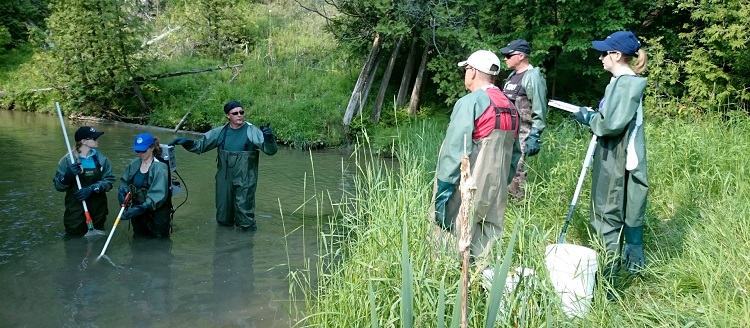
The five-day Ontario Stream Assessment Protocol (OSAP) course is designed to train and certify users in a variety of standardized stream assessment techniques for evaluating habitat, benthos and fish communities in Ontario’s wadeable streams.
Course Description
The methods taught are documented in the OSAP Manual and are provincially recognized as standards by the Ontario Ministry of Natural Resources and Forestry and federally recognized by Fisheries and Oceans Canada. Like the modular OSAP manual, the training is organized into the following complementary units:
- Identifying and documenting site locations
- Benthos sampling
- Temperature sampling
- Fish community sampling, including Class 2 backpack electrofishing certification
- Characterizing physical processes and in-stream structure
- Data management
Introductory (i.e. Level 1) benthos identification (OBBN) and Level 1 and Level 2 fish identification courses are offered concurrently on the weekend preceding the OSAP course.
When Is It Offered?
The next course will be offered in Spring 2021 in Oshawa, Ontario. Join Wait List:
Who Should Attend?
This course is intended for field crews and resource managers involved in stream surveys and management. Registration preference will be given to professionals in the field who have need of using the OSAP protocol in the calendar year the course is offered. Please be advised that registration usually fills up quickly.
Reference Materials
The Ontario Stream Assessment Protocol (OSAP) contains a series of standardized methodologies for identifying sites and evaluating benthos, fish communities, physical habitat and water temperatures in wadeable streams. The OSAP provides standard methodologies that allow data to be shared, used for multiple purposes and stored in a common database.
The materials provided in this manual are intended to compliment the procedures described in the Ontario Stream Assessment Protocol by providing advice on study design and interpretation of results.
The Flowing Waters Information System (FWIS) helps Ontario’s conservation practitioners to manage information on flowing waters or streams, including data about fisheries, benthos, habitat and more. Watch the Introduction to the Flowing Waters Information System video to learn more!
2019 OSAP FIELD FORMS (updated to enable digital input):
- Rapid Assessment Channel Morphology (S4M1)
- Channel Morphology (S4M2)
- Bankfull Channel Stability (S4M3)
- Rapid Stream Discharge Survey (S4M4)
- Crest Stage Gauge: Water Level Record (S4M6)
- Site Slope (S4M7)
- Rapid Assessment Methodology Substrate (S4M8)
- Stream Crossing and Barriers (S4M9)
- Headwater Drainage Features: Up and Down Stream (S4M10)
- Headwater Drainage Features: Unconstrained (S4M11)