The Living City depends on a network of natural habitats to maintain biodiversity and a healthy environment for the benefit of all living things. Toronto and Region Conservation Authority (TRCA) is working to identify and build this critical network of natural areas through its innovative Terrestrial Natural Heritage Program.
Based on an extensive inventory of our regions forests and wetlands, animals and plants, the program will provide information on the health of our region and monitor changes. It will show the linkages between terrestrial natural systems and aquatic habitats, water management, air quality, loss of species, recreation, safety and aesthetics. It will identify the ideal network of natural areas needed for a healthy functioning ecosystem and set priorities for protection and restoration. Most importantly, it will provide a science-based tool that will help inform planning and development decisions that protect important natural features and functions.
What is Terrestrial Natural Heritage?
Terrestrial Natural Heritage includes plants, animals and natural communities associated with the land, as opposed to aquatic environments. It encompasses wetlands and plants and animals that require land for at least part of their life cycle (such as amphibians and waterfowl).
Terrestrial Natural Heritage includes: Water, Land, Air and forest
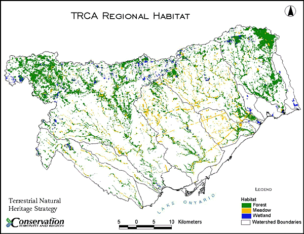
Our Natural Heritage System
A Natural Heritage System consists of all of the natural cover in a region. It is called a “system” because of the interactions and dependencies between and among its parts.
According to the Great Lakes Remedial Action Plan, the recommended amount of natural cover needed for reasonably healthy and resilient ecosystems is 30 per cent. Currently, natural cover in the TRCA region stands at approximately 17 per cent and falls as low as 5 per cent in some municipalities.
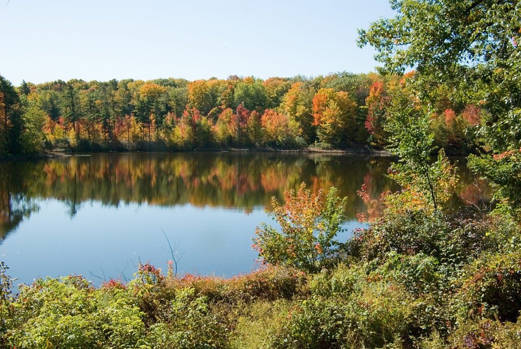
In the more rural areas of the jurisdiction, such as the Oak Ridges Moraine in the north and the Duffins Watershed and Rouge Valley in the east, more sizable areas of natural habitat remain with some remarkable natural heritage features. Rouge Park, for example, possesses a high diversity of plant and animal species and is a vital ecological link between Lake Ontario and inland areas. As well, Tommy Thompson Park on the waterfront is an important haven for migrating birds.
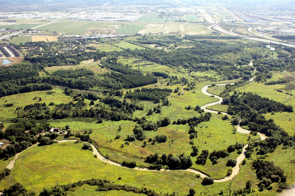
Fragmentation
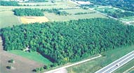
Habitat fragmentation, particularly forest fragmentation, is a major concern for terrestrial habitat within the TRCA’s jurisdiction.
 Plant and animal populations are seriously affected by fragmentation. For example, animals that require cover for movement are unable to cross open agricultural areas between forest patches due to the risk of predation. Other barriers such as roads and urban areas are formidable or dangerous obstacles to animal movement.
 Habitat fragments – especially forests – have edges on all sides. The issue of negative “edge effects” is of particular concern for biodiversity in fragmented forest landscapes. These negative effects include: increased wind damage and drying, growing populations of non-native species which crowd out other plants, and increased predation of birds and other small animals by such species as raccoons, skunks, foxes, crows, etc.
 Habitat fragments are also more vulnerable to disturbance by humans. Recreational pressures can lead to trampling, erosion, and the accidental introduction of invasive exotic plants. Wildflowers are often picked or removed to be transplanted in people’s gardens. Amphibians and reptiles are collected by children, and house cats hunt for birds and small mammals. Dumping of refuse in natural areas remains a common practice, while pesticides, pollutants, and dust can drift in to habitat patches and affect sensitive species. Even noise from backyards, industry, or construction can disrupt the activities of some species.
Biodiversity in Our System
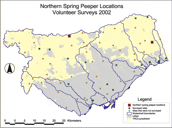
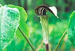
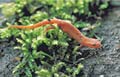
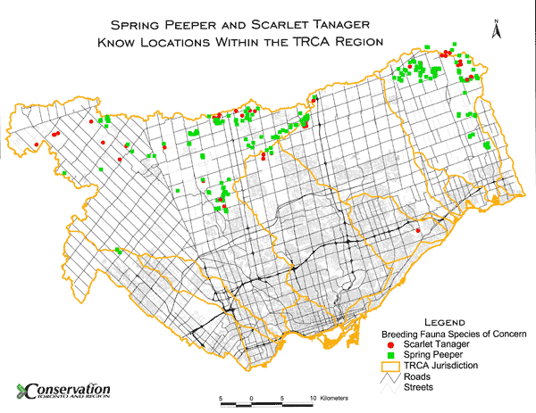
The TRCA has identified more than 200 flora and fauna “species of concern” that are at risk in the region due to habitat loss or sensitivity to urbanization. Sensitive species that are indicators of good health in our environment, such as spring peepers and scarlet tanagers, have been extirpated (extinct locally) from the southern urbanized portion of the region. Helping to conserve and enhance biodiversity in the region will ensure that there will be opportunities for us and our children to experience the richness and variety of life which has evolved over millions of years.
Terrestrial Natural Heritage System Strategy (TNHSS)
- The Strategy -2,014K
- Appendix A -1,598K
- Appendix B -1,638K
- Appendix C -1,664K
- Appendix D -2,348K
- Appendix E -3,940K
- Appendix F -1,062K
- Appendix G -1,062K
- Appendix H -1,026K
- Appendix I -1,397K
- Appendix J -1,031K
Terrestrial Volunteer Monitoring Program
- Monitoring Results 2002-2007 – 2,223K
About Our Approach
Using ecological data collected from aerial photography and field investigations, mapping and ongoing monitoring of species and habitat conditions, this approach will provide a powerful tool to direct land use policy, strategic planning and environmental decision-making.
Introduction
The Terrestrial Natural Heritage approach identifies and evaluates natural heritage systems and assesses the status of habitats and species. Using ecological data collected from aerial photography and field investigations, mapping and ongoing monitoring of species and habitat conditions, this approach will provide a powerful tool to direct land use policy, strategic planning and environmental decision-making.
Premise
Complex ecological information is needed for making informed decisions about Terrestrial Natural Heritage. Currently, land-use decisions are made on a site-by-site basis, and fail to consider cumulative impacts. A regional strategy is required to set a context for making ecologically sound decisions. In addition, conservation planning has focused on protecting only the best or most representative natural heritage features. Our approach addresses all of these concerns in order to counteract the degradation of our natural heritage system due to habitat loss, fragmentation and increased urbanization
Objectives
- to give clear direction for data collection, land acquisition, ecological restoration and stewardship
- to provide a systems context and address the cumulative impacts of land use changes in a comprehensive and standardized manner
- to be efficient, transparent and accessible
- to raise public, governmental, and agency awareness of our role in making decisions on a shared environment
- to motivate positive change
- to educate and engage the public in decision-making
- to provide a strong basis for setting proactive targets for protection
Methodology
Our approach organizes aspects of terrestrial natural systems into three categories (or indicators):
- The Landscape
- Vegetation Communities
- Plant and Animal Species
This three-level framework will be used for each of the following components of the approach.
1. Ranking
Assessing the conservation status of the habitat patches, vegetation communities, flora species and fauna species using a quantitative scoring and ranking system.
Landscape
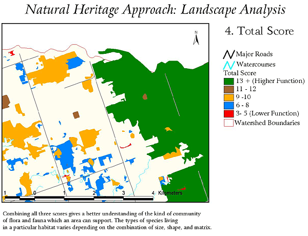
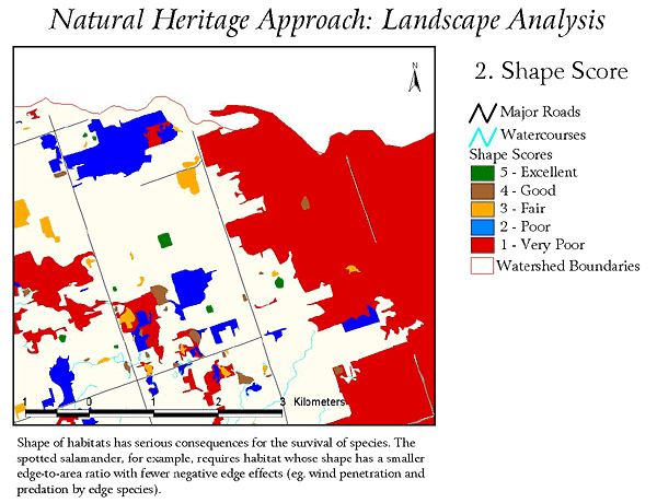
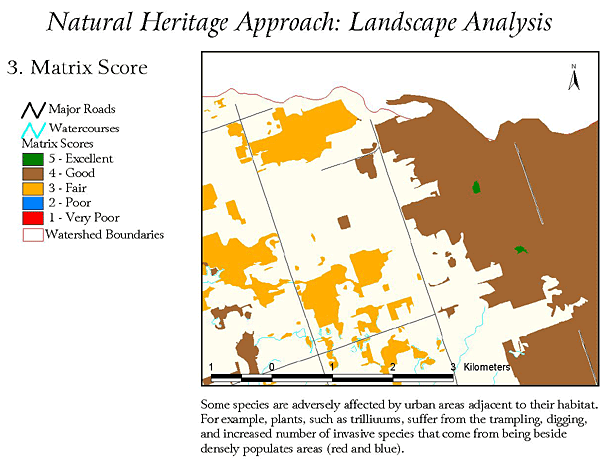
Every patch of natural habitat in the region is ranked from 1 to 5 according to a series of landscape criteria, including size, shape and surrounding land use (matrix influence). The Total Score for these criteria tells us something about how well a habitat patch may be functioning.
Landscape Criteria
Vegetation Communities
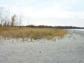
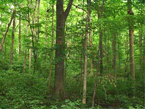
The Ministry of Natural Resources has defined different types of habitats in southern Ontario, according to dominant tree species, the variety of other plants that grow with them and soil and moisture conditions. Our approach applies this Ecological Land Classification system which recognizes many types of vegetation communities ranging from wetlands, meadows, beaches and savannahs. Click here for more information about the Ministry’s classification system.
TRCA biologists assign each type of vegetation community a rank, according to its abundance and ecological needs. The map below shows in detail all of the types of vegetation communities that are found in a valley within the TRCA jurisdiction.
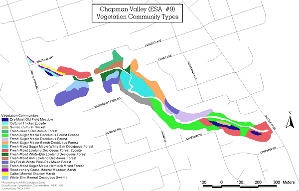
The types of vegetation communities
In the past, a species has not been considered a conservation concern unless it is rare. Ironically, protecting a species only when its population number is low results in more species becoming rare. The Terrestrial Natural Heritage approach uses a more proactive way to monitor species.
Species are all given a rank for their conservation status, according to not just rarity but also their sensitivity to disturbance and their specialized ecological needs. This will be used to address both the goals of preventing rarity and of setting goals for a healthier system.
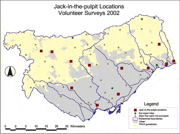
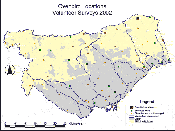
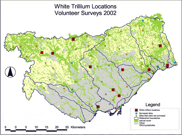
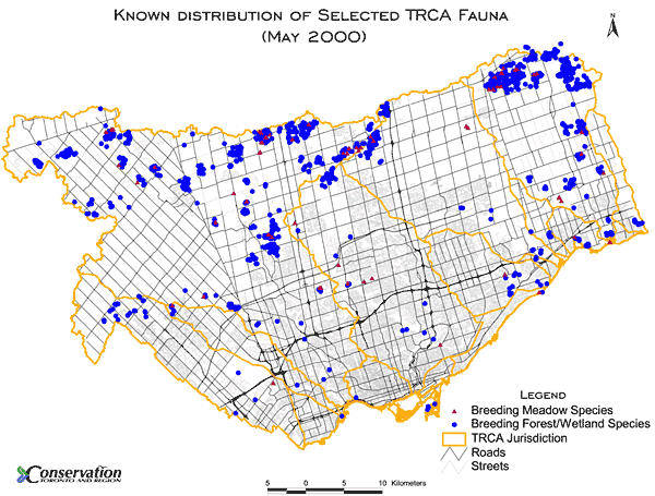
Maps are developed, showing species of concern that have been observed in the TRCA region. The map below shows that most of the animal species of concern occur in the northern, more rural areas of our region.
2. Data Collection
Collecting information about the habitat patches, vegetation communities and species.
Recent aerial photography is used to collect information at the landscape level. Data concerning vegetation communities is collected in the field by accredited biologists. Species data is gathered by both biologists and by trained volunteers. Also, other life science information is checked and entered into our database. All of this information is used in our ongoing monitoring program (see below).
3. Evaluation
Combining the information to describe the natural heritage system.
Our approach uses the assigned ranks to evaluate terrestrial natural systems at any scale, from the region down to individual sites. The ranks are employed in analysing and reporting under a variety of measures such as the percentage of natural cover in the region or the distribution of species of concern. This analysis is used to evaluate health and to inform the decision-making process (target setting and strategy development).
4. Target Setting
Defining a healthier system.
The TRCA sets measurable targets for attaining a healthier natural system. The Approach incorporates a modelling exercise that uses Geographic Information Systems to evaluate potential conditions at any scale from the region to watersheds, down to individual sites. Both positive and negative changes of various scenarios can be predicted using the modelling. Maps are created to show potential improvements in the landscape by modelling meadows or agricultural lands into forest (or wetland).
5. Strategy Development
Making plans for attaining and sustaining a healthy system.
TRCA’s Terrestrial Natural Heritage System (TNHS) Strategy proposes an achievable and sustainable vision for the future of the Toronto region’s terrestrial natural heritage and describes how we can get there. It uses science-based analytical tools, based on sound ecological criteria, to identify an expanded and targeted land base for inclusion in a terrestrial natural heritage system. The strategy incorporates the most rigorous current thinking on terrestrial natural heritage protection and restoration principles to identify quantity, quality and distribution targets for a terrestrial natural heritage system. In addition, the most comprehensive data on the Toronto region’s terrestrial natural heritage assets were used to develop the strategy. Strategic directions for stewardship and securement of the land base, a land use policy framework will help to achieve the target TNHS, and other implementation mechanisms are included in the strategy.
The TNHS Strategy was completed and approved, in principle, by the TRCA Board of Directors in 2007. The Terrestrial Natural Heritage System Strategy is a very important piece of The Living City objectives for Regional Biodiversity and Sustainable Communities.
6. Monitoring and Reporting
Keeping track of the system over time.
The TRCA is developing a Watershed Monitoring Network, which includes terrestrial, aquatic, and water management monitoring protocols. The protocols will measure terrestrial and aquatic health over the long term. The intent of the Network is to bring community and government initiatives together to form a more complete program.
The terrestrial monitoring program will fill the current need for landscape, vegetation communities and species indicators to be comprehensively monitored and reported on at regular intervals.
Progress Report
- Download The Terrestrial Natural Heritage Program of Living City Progress Report -11,750K
- Terrestrial Volunteer Monitoring Program Progress Report 2006 -6,425K
Monitoring Maps