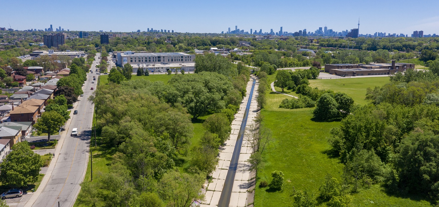
The Rockcliffe-Smythe neighbourhood along Black Creek in the City of Toronto is a highly flood-vulnerable area and has experienced both riverine and urban flooding during extreme storm events.
The City of Toronto, together with Toronto and Region Conservation Authority (TRCA), have initiated a Municipal Class Environmental Assessment (MCEA) to determine a preferred riverine flood mitigation strategy for the Rockcliffe-Smythe neighbourhood.
This study will build upon recent advancements in the understanding of the causes of flooding within the community. Completion of the MCEA is the next step necessary to meet regulatory requirements prior to construction.
VIEW THE NOTICE OF COMMENCEMENT
Explore the Project


PROJECT OVERVIEW
The primary objective of the Rockcliffe Riverine Flood Mitigation Municipal Class Environmental Assessment is to minimize riverine flood risk in the Rockcliffe-Smythe area, to the extent practical, with robust and low-maintenance solutions, while minimizing and mitigating potential impacts resulting from the implementation of flood mitigation measures, and coordinating riverine flood mitigation designs with concurrent transportation, sewer and drainage projects in the study area.
This study will incorporate and expand on the previous flood mitigation studies completed in this area, including the Black Creek (Rockcliffe Area) Riverine Flood Management Class Environmental Assessment (2014) and the recently completed Black Creek at Rockcliffe Special Policy Area Flood Remediation and Transportation Feasibility Study (2020).
It is anticipated that the City of Toronto, in conjunction with TRCA, will undertake the Municipal Class EA process in accordance with the requirements for Schedule C projects. This will require completion of Phases 1 through 4 of the Municipal Class EA process.
Upon completion of the study, an Environmental Study Report (ESR) documenting the planning and decision-making processes will be prepared for public and agency review and comment.
There will be public and stakeholder consultation activities over the course of the study as per the Municipal Class EA process. Public notice of future consultation events will be advertised in advance of the event.
Public notices will be posted on this website and emailed directly to the project mailing list, and hard copies of notices will be distributed within the scoped study area in advance of future consultation events.
If you would like to be added to the project mailing list please contact us.
Project Objectives:
This Municipal Class EA (MCEA) project is being undertaken to determine the preferred riverine flood mitigation strategy for the Rockcliffe-Smythe neighbourhood in the City of Toronto.
Conceptual design drawings of the preferred flood mitigation strategy will be prepared, as well as a phased multi-year implementation plan for construction.
Completion of the MCEA is the next step necessary to meet regulatory requirements prior to construction.
The primary objectives of the riverine flood mitigation strategy are:
- To minimize riverine flood risk in the Rockcliffe-Smythe neighbourhood to the extent practical
- To develop robust and low-maintenance flood mitigation solutions
- To minimize and mitigate potential impacts resulting from the implementation of flood mitigation solutions
- To coordinate riverine flood mitigation designs with concurrent transportation, sewer, and drainage projects in the study area
STUDY AREA
Select image to view full-sized map

PROJECT PROGRESS
| Winter 2021 Notice of Project Commencement |
 |
| Winter 2021 Baseline Inventory, Problem & Opportunity |
 |
| Spring 2021 Alternative Solutions |
|
| Summer 2021 Public Information Centre #1 |
|
| Fall 2021 Design Concepts for Preferred Solution |
|
| Winter 2022 Public Information Centre #2 |
|
| Spring 2022 Environmental Study Report |
|
| Summer 2022 Report Available for Public Review |
|
| Summer 2022 Anticipated Approval of EA |
|
The Rockcliffe Riverine Flood Mitigation Project is following the Class Environmental Assessment process for municipal infrastructure projects outlined by the Municipal Engineers Association and approved by the Minister of the Environment and Climate Change.
|
|
– Marks points of public consultation. |
PROJECT BACKGROUND
The Rockcliffe area is the most flood vulnerable area in TRCA’s jurisdiction.
There are hundreds of buildings within the floodplain; many of these properties have experienced surface and basement flooding during severe storms due to a combination of riverine flooding, inadequate surface drainage, and overloading of the City’s sewer systems.
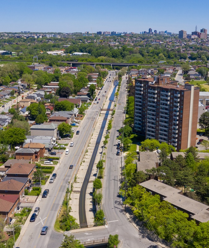
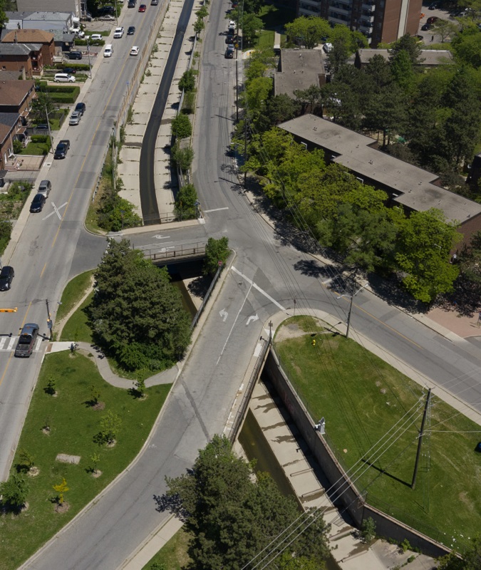
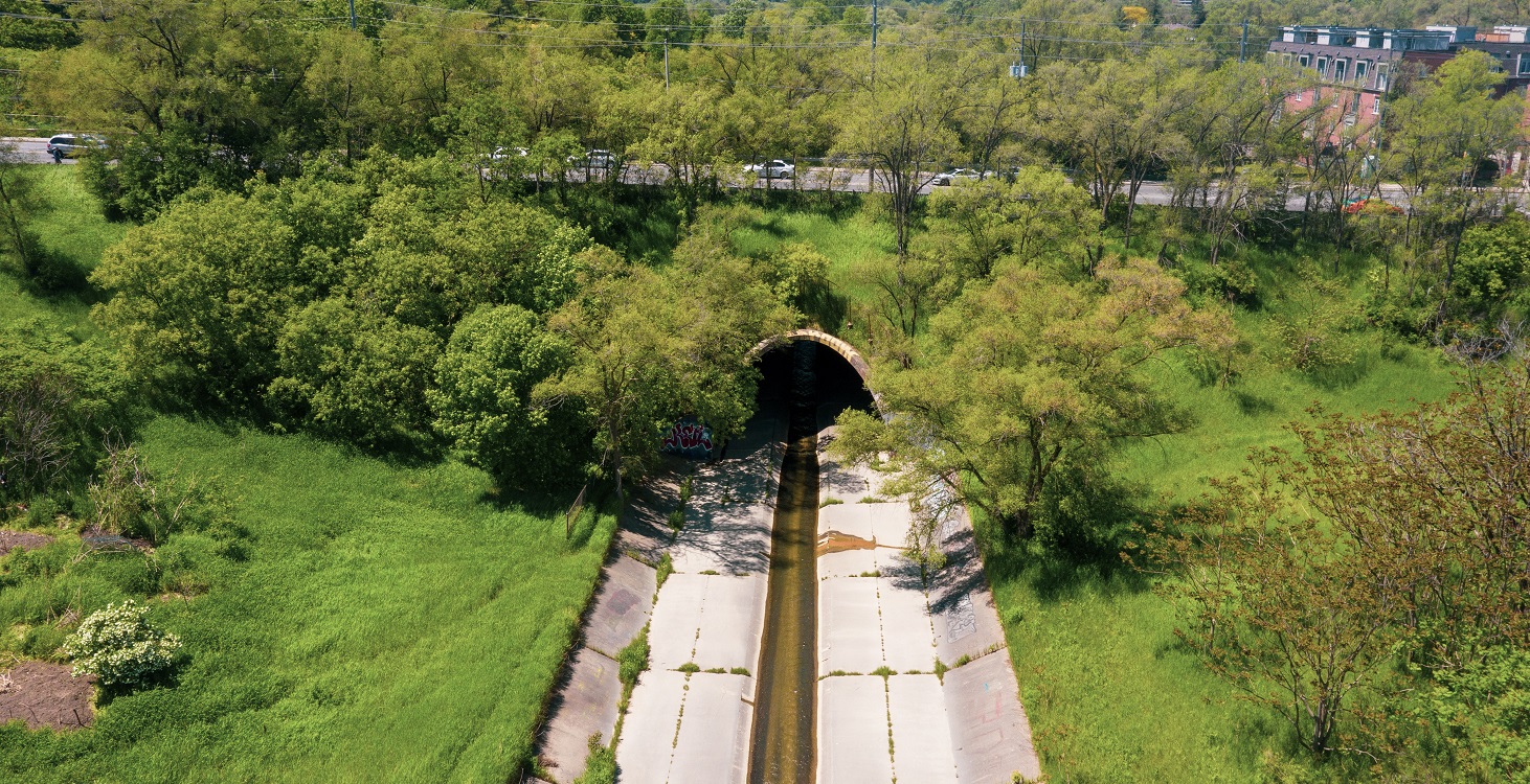
Factors that contribute to the flooding of Black Creek in the Rockcliffe area relate to alterations to the Black Creek channel and residential development over the past 70 years.
Residential urban development in this area and the corresponding alterations to Black Creek occurred primarily during and after the 1940s. Channelization of Black Creek occurred as early as 1942 along Humber Boulevard, parallel to Cordella Avenue. These early alterations to Black Creek predate the Hurricane Hazel event in 1954, and were not intended to be flood control measures.
Following the substantial flooding caused by Hurricane Hazel, several remediation measures were proposed in the Black Creek Flood Control Plan and the 1959 Plan for Flood Control by the Metropolitan Toronto and Region Conservation Authority.
The Black Creek Flood Control Plan outlined additional alterations to Black Creek to provide for riverine flood protection, including the construction of a flow attenuation dam north of Wilson Avenue, and further channelization of Black Creek between Weston Road and its confluence with the main Humber River.
Similar to other post-Hurricane Hazel Flood Control Plans, not every measure identified in the Black Creek Flood Control Plan was implemented. However, two key riverine flood control measures were implemented: the expansion of the Black Creek channel (constructed in 1959), and the Black Creek flow attenuation dam (completed in the 1960s).
These flood control measures were designed based on the available methods and information at that time, and without the availability of streamflow records. In addition, land use assumptions at the time were different from how the upstream areas actually developed in subsequent years.
As a result, these flood protection measures on Black Creek, while providing some riverine flood remediation benefits, do not fully protect the area from riverine flooding.
With a highly urbanized and altered drainage area, together with the many engineered channel sections, Black Creek is currently an extremely flashy watercourse, with floodwaters that quickly accumulate into and pass through the system.
With the historic development in the most low-lying areas of the floodplain, many of the 366 properties in the regulatory floodplain are at high risk of riverine flooding during more frequent events.
DO YOU LIVE IN AN AREA AT RISK OF RIVERINE FLOODING?
Riverine flooding occurs when the water levels of rivers rise, overflowing their banks. This is different than urban flooding, which consists of street flooding, basement flooding, and flooding of other low-lying areas due to the overflow of local drainage systems.
Water levels in Black Creek channel can impact the performance of City of Toronto’s sewer systems and combine with other factors to contribute to the basement flooding of homes within and outside of the regulatory floodplain limits of the Rockcliffe area.
During storm events, high water levels in Black Creek, in combination with excess rain runoff from roads and other hard surfaces, restricts the ability of storm and combined sewers to discharge adequate stormwater downstream into the creek. This situation contributes to the surcharge of storm sewers.
When water levels in Black and Lavender Creek rise over the channel banks and spill onto roads, significant volumes of water from both creeks can also enter the storm and combined sewer systems, along with rain water, through catch basins and maintenance hole covers, as well as from plumbing systems on private properties, which can contribute to overloading these sewer systems.
View the City of Toronto’s basement flooding study area webpage for Black Creek.
TRCA identifies and ranks areas at risk of riverine flooding (i.e., flood vulnerable clusters) through a Flood Risk Assessment process that considers flood damages and social vulnerabilities. Currently, 43 flood vulnerable area clusters have been identified across TRCA’s jurisdiction as priority areas.
Since 2008, the Rockcliffe area has been ranked among the top five priority areas for riverine flood risk within TRCA’s jurisdictional area. It is currently ranked the highest priority area for riverine flood risk within Toronto. Rockcliffe was the first flood risk priority area selected by the TRCA to commence an EA study (completed in 2014) to investigate riverine flooding and recommend solutions.
Study Initiatives:
Black Creek (Rockcliffe Area) Riverine Flood Management
Class Environmental Assessment (2014)
In 2014, TRCA and the City of Toronto completed separate Environmental Assessment (EA) studies that investigated options and recommended measures to reduce riverine and urban (sewer system) related flooding, respectively.
The EA completed by TRCA followed the Class Environmental Assessment process for Remedial Flood and Erosion Control Projects outlined by Conservation Ontario, and focused on developing a riverine flood mitigation solution that would mitigate flooding during the most extreme flood events.
DOWNLOAD THE 2014 TRCA ENVIRONMENTAL ASSESSMENT
City of Toronto Basement Flooding Investigation
Environmental Assessment Studies
Black Creek at Rockcliffe Special Policy Area Flood Remediation and Transportation Feasibility Study (2020)
In 2018, due to the level of flood risk within the Rockcliffe Special Policy Area (SPA), and the advancement of modelling and mapping technology, TRCA initiated and completed a new 2-Dimensional hydraulic model for the Rockcliffe SPA.
The modelled results indicate that flood remediation solutions proposed in the 2014 EA would not protect vulnerable houses from the more frequently occurring flooding. This is because Lavender Creek is now understood to be a significant source of flooding along Hilldale Road.
Based on new hydraulic modelling and data collected by TRCA during the July 2013 and August 2018 flood events, the City of Toronto and TRCA have a new understanding of flood conditions within the Rockcliffe SPA. This new information and modelling led the City and TRCA to collaboratively undertake a Flood Remediation and Transportation Feasibility Study.
In 2020, the Flood Remediation and Transportation Feasibility Study was completed. The objectives of this study were: to expand riverine flood protection options, placing greater focus on remediating the areas of greatest riverine flood risk; assess those flood remediation options against traffic and transportation needs; and to develop a roadmap for implementation.
VIEW THE 2020 FLOOD REMEDIATION AND TRANSPORTATION FEASIBILITY STUDY:
PRESENTATION MATERIALS & PUBLIC NOTICES
CONTACT INFORMATION
Have questions? Want to join the project mailing list? Please contact:
Rockcliffe EA Project Coordinator
Toronto and Region Conservation Authority
101 Exchange Avenue, Vaughan ON L4K 5R6
Email: RockcliffeEA@trca.ca
Phone: (416) 661-6600 ext 6471