Land Use
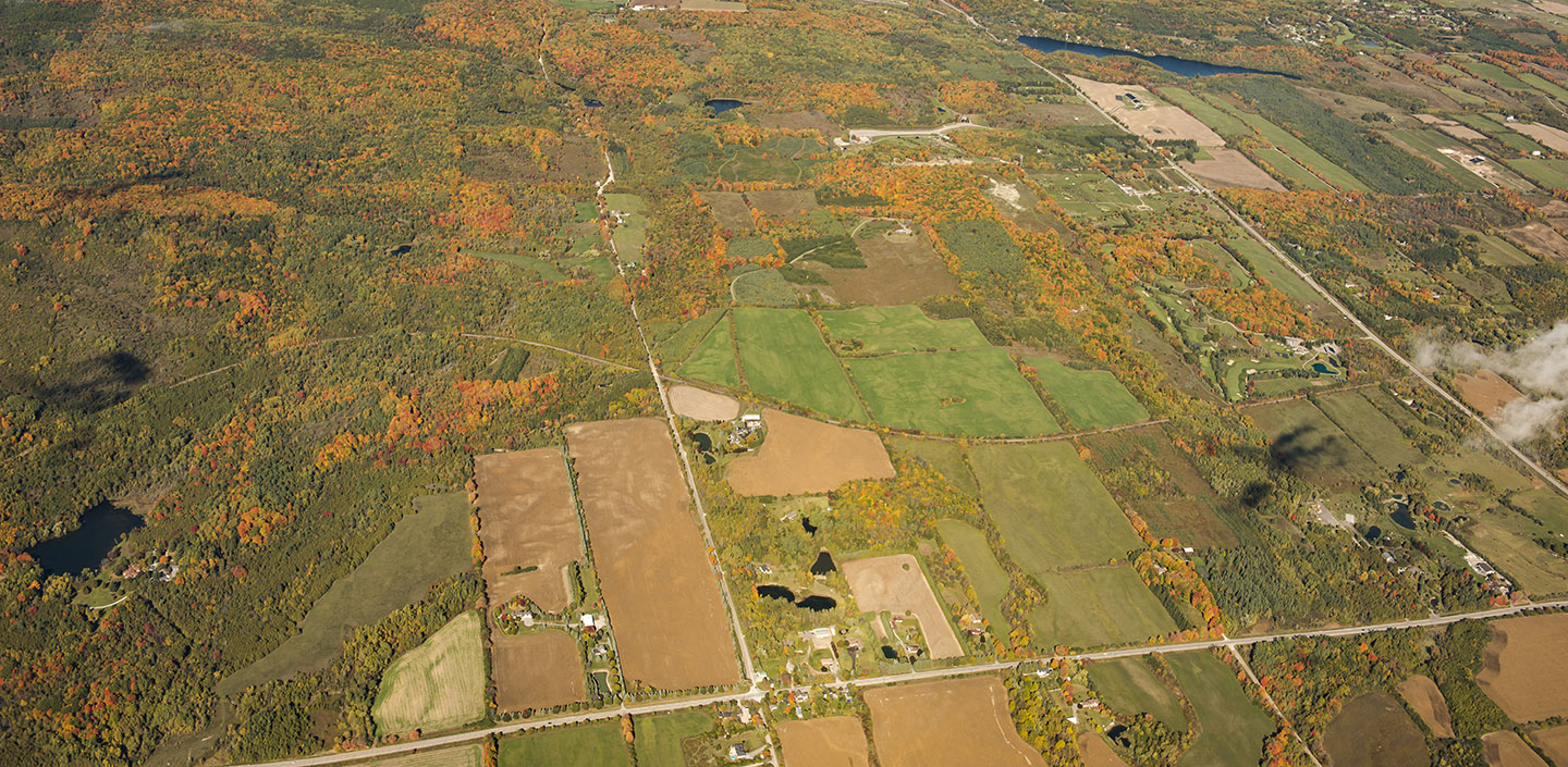
While Duffins Creek watershed has experienced urban growth in recent years, only 10% of the lands are urban, and 19% are urbanising. 71% of the watershed still has a predominantly rural landscape.
Rural areas dominate the north of the watershed, and the southern portions are urban or urbanising. Farming activity includes livestock, crops, and orchards. Parts of the northwest area of the watershed are protected in Rouge National Urban Park, there is no public access to these lands at this time. Many estate subdivisions and rural non-farm residences are also found in the rural area.
Land Forms
Duffins Creek watershed has three physiographic units: Oak Ridges Moraine, South slope, and the Lake Iroquois plain.
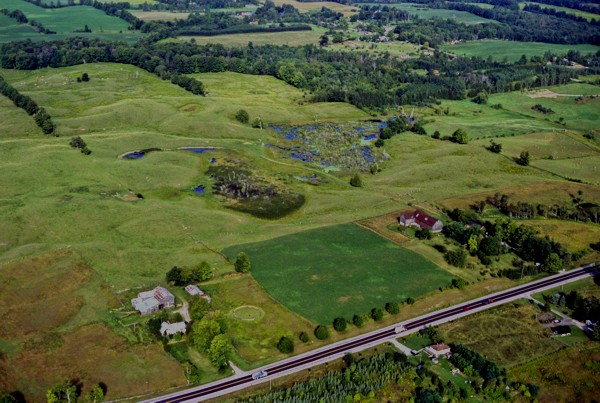
The Oak Ridges Moraine is an upland area, the source of many streams like Duffins Creek which drain into Lake Ontario to the south. The Moraine’s hilly terrain is composed mainly of sand and gravel, with scattered small ponds.
The South Slope of the Oak Ridges Moraine has many drumlins, which are long and narrow mounds pointing upslope formed from glacial debris. Fast-flowing streams in this area carved sharp valleys through the glacial till, an accumulation of unsorted, unstratified mixtures of clay, silt, sand, gravel and boulders. Many types of soil are found along the South slope, some of which are good for agriculture.
Along the shoreline of ancient Lake Iroquois, coarse soil particles like sand and gravel settled during glacial retreat, leaving a band of sandy soils. To the south, the Lake Iroquois plain is composed mainly of clay, and gently slopes towards the shore of Lake Ontario.
Ecosystems
Historically, Duffins Creek watershed was dominated by vast forests which had tremendous influence on the hydrology of the watershed. With European settlement came deforestation and a variety of agricultural practices which negatively impacted the system. Other changes due to urbanisation, such as transportation corridors, groundwater extraction, in-stream barriers, and ponds, have negatively impacted the watershed. At present, the impacts to aquatic habitat and species have not been substantial, due to the limited area of urban development in the watershed.
The high proportion of rural land in Duffins Creek watershed means that 40% of the watershed has natural cover, of which 25% is forest, 11% is meadow, 3% is successional, and 2% is wetland.
Duffins Creek’s 81 kilometres of streams are in relatively good condition and are dominated by cold water aquatic communities such as sculpin, trout, and numerous other fish species.
Over the past 50 years, conditions in some areas of the watershed have improved. For example, in some headwater areas of Duffins Creek where the glacial soils are poor for agriculture, and in the provincial Seaton and federal airport lands, there has been significant ecological restoration and natural regeneration of table land and riparian forests. This increased forest cover has reduced surface flows and stabilised the overall flow regime. The result is better aquatic habitat and an overall improvement in the condition of some fish communities.
In the 1950s, during the first extensive fish survey of the Duffins Creek watershed, sensitive species such as brook trout and sculpin were largely restricted to the headwater areas. Since the 1950s the conditions have improved and these species have extended their range to other areas of the creek system. Many areas still require an increase in woody riparian vegetation to provide habitat for cold water species. There is still room for improvement to the aquatic system.