The Don River watershed stretches about 38 kilometres from the Oak Ridges Moraine down to Lake Ontario. Although there is no end-to-end valley trail, the Don offers many opportunities for long and short nature walks in and around the city.
Walk the Don
Walk the Don is a series of self-guided trail guides located throughout the Don River valley. All guides include a detailed trail map, level of difficulty, parking information, duration and detailed points of interest along the way. All routes use established trails and are suitable for family use.
Follow a section of Burke Brook, a tributary of the West Don River, as it winds its way through a varied urban area. The walk begins where the stream is buried beneath a formal garden and ends as it flows naturally through a forested ravine.
East Don Parkland Guide | Companion East Don Parkland Audio Guide
Discover the natural heritage of this popular trail through the East Don Parkland. Follow German Mills Creek and the East Don River as they meander through lush forested ravine, wildflower meadows and wetlands teeming with life. The natural channel, series of wetlands and abundance of native species make this section of the East Don River well worth the exploration.
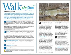
This walk begins along the West Don River, crosses to the East Don River and then passes the Forks of the Don where the two tributaries unite to form the Lower Don River. This section of the Don Valley, once heavily industrialized, now struggles to regain a natural state, and is often hampered by flood damage from heavy storms.
Lower Bartley Smith Greenway Guide
This walk follows the Upper West Don River in the City of Vaughan southwards from Langstaff Park on Langstaff Road to Steeles Avenue West.
Explore the Lower Don, the site of one of the largest urban environmental restoration projects in the world.
Once an active industrial site in the 19th century, Milne Hollow demonstrates how a natural green space, two railways and an expressway can coexist in an urban environment, yet give the feeling of being in the wilderness.
Experience a walk along routes of three buried waterways, all hidden from public view decades ago in the interest of progress. Enjoy the natural serenity of living ponds on the former site of Toronto’s largest brick works, right in the heart of the city.
The Taylor family of paper mill fame owned the land west of Dawes Road to the Forks of the Don and the Massey Family’s Dentonia Farm occupied the land east of Dawes Road to Pharmacy Avenue. It was also known as Silver Creek in the past.
This loop offers a series of contrasts. The walk begins in manicured gardens, meanders through an ever-changing and challenged valley, climbs the shore of an ancient lake and descends into the wider valley of the West Don River. It follows a small watercourse degraded through intense pressure from rapid urban development.
Places of interest
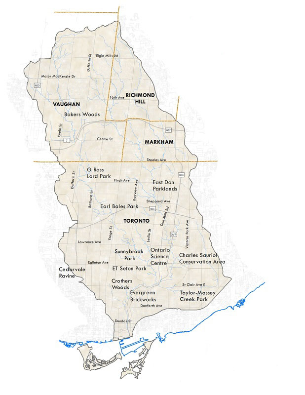
- Charles Sauriol Conservation Area
- Crothers Woods
- Don Valley Brick Works
- Earl Bales Park
- East Don Parkland
- E. T. Seton Park
- Forks of the Don
- G. Ross Lord Park and Dam
- Oak Ridges Moraine
- Lower Don Parklands
- Riverdale Farm
- Sunnybrook Park
- Taylor Creek Park
- Toronto Botanical Garden
- Todmorden Mills
- Wilket Creek Park