Carruthers Creek is a relatively small watershed with a drainage area of approximately 3,748 hectares, ranging from two to three kilometres in width, and only 18 kilometres in length. It is the easternmost watershed in TRCA’s jurisdiction, located entirely in the Region of Durham.
Land Use
The watershed is mainly rural north of Highway 7. From Highway 7 south to Taunton Road, the majority of lands are in the Protected Countryside of the provincial Greenbelt. Low to medium density suburban development predominates from Taunton Road south to the lakeshore.
There are differences in agricultural land use in the upper reaches versus mid-reaches of the watershed which may be attributed to land tenure, drainage and soil properties, or a combination of factors. Horticulture dominates the east branch, whereas the west branch is predominantly cash crops and at least one livestock operation, although horticulture is also present.
In the urban areas of Ajax, some lands slated for development are still cultivated with cash crops as an interim use. Overall, the land use in this small watershed is in transition.
Land Forms
The watershed occurs within the South Slope and Glacial Lake Iroquois physiographic regions, south of the Oak Ridges Moraine.
Topographically, most of Carruthers Creek watershed is flat to slightly rolling. The exceptions are low hills associated with the Lake Iroquois Shoreline, notably the Kinsale Raised Shoreline immediately west of Audley Road and south of Highway 7, and the main valley feature of Carruthers Creek, which forms a distinct but shallow ravine from Taunton Road south to Highway 401.
Carruthers Creek’s headwaters form to the south of the Oak Ridges Moraine. Both the east and west branches of the creek originate north of Concession 8 and the confluence, where the two branches of the creek join, is immediately north of Taunton Road.
Carruthers Creek contains a total of 61 kilometres of stream channels; the creek enters Lake Ontario in the Town of Ajax.
Ecosystems
Historically, portions of the watershed would have supported cold water fish populations including Brook trout, Atlantic salmon, Slimy sculpin, and Mottled sculpin.
Instream barriers to fish movement in the watershed adversely impact the aquatic system by limiting access to feeding and spawning areas, increasing water temperature, and affecting sediment transport. Some instream structures increase water velocities to the point where fish passage is prevented. Structures that act as barriers to fish passage include dams, weirs, road and rail crossings, and some culverts.
Carruthers Creek watershed lies in the Great Lakes-St. Lawrence floristic region, which consists of mixed coniferous-deciduous forest.
There are two provincial Areas of Natural and Scientific Interest (ANSl), as designated by the Ontario Ministry of Natural Resources and Forestry, in the watershed:
- The Kinsale Raised Shoreline Earth Science ANSI, designated for its distinct geological character as a well preserved part of the ancient Lake Iroquois Shoreline.
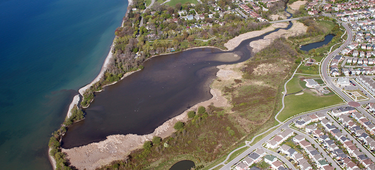
- Shoal Point Marsh Life Science ANSI, which is included in the coastal Carruthers Creek Wetland Complex Provincially Significant Wetland.
Two smaller wetlands are evaluated as Locally Significant: the Rossland Road Wetland Complex and the Salem Road Wetland Complex. The Carruthers Creek Wetland Complex is divided into two Environmentally Significant Areas: the coastal Carruthers Marsh and the Carruthers Creek Forest, a few hundred metres inland.