Toronto and Region Conservation Authority (TRCA) has proposed to undertake infrastructure protection works within German Mills Settlers Park in order to provide long-term protection to at-risk sanitary sewer infrastructure.
Project Location
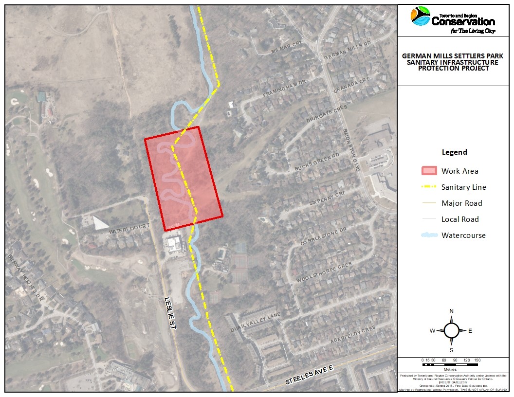
The German Mills Settlers Park Sanitary Protection Project is located along an estimated 260 metre stretch of German Mills Creek, located within the Don River watershed. The project area is within municipally owned property known as German Mills Settlers Park, situated west of Don Mills Road between John Street and Steeles Avenue East, in the City of Markham. A public trail and a York Region 750 mm diameter sanitary line run parallel to the east bank of the watercourse from John Street to the southern limits of the park. Within certain locations of the proposed project area, the sanitary line crosses the watercourse as shown in Figure 1 below.
Learn More About This Project


Project Background
In 2011, TRCA developed the Infrastructure Hazard Monitoring Program (IHMP). The purpose of the IHMP is to ensure timely identification of risk to infrastructure due to watercourse activity (i.e. channel migration, widening, etc.) and efficient prioritization and mitigation of such risks in collaboration with stakeholders. The IHMP broadly divides watercourse erosion risks into two types of sites: intersection sites to assess the risk of bed erosion where the sewer crosses a watercourse, and proximity sites to assess the risk of bank erosion and lateral channel adjustments in close vicinity to the infrastructure. Intersection sites are categorized using an “I-” identifier, while proximity sites are categorized using a “P-” identifier.
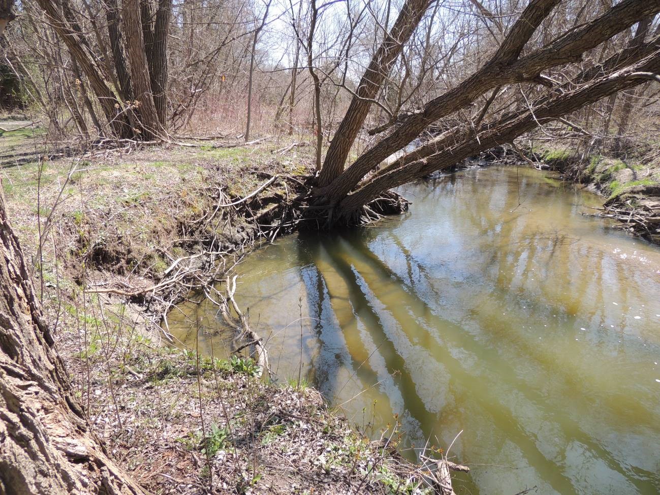
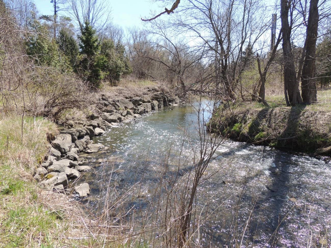
The 750 mm diameter sanitary main was installed within German Mills Settlers Park in 1970. Over the past 49 years, German Mills Creek has naturally migrated within the flood plain and has shifted over or in close proximity to the sanitary main or associated maintenance chambers. As a result, the watercourse is now at risk of exposing the sanitary infrastructure at six distinct locations within German Mills Settlers Park. Three alternative solutions have been proposed to protect sanitary infrastructure. As such, a Schedule B Municipal Class Environmental Assessment for Water and Wastewater Projects is being utilized as part of the planning and design process for this project.
Schedule B Municipal Class Environmental Assessment for Water and Wastewater Projects
A Municipal Class Environmental Assessment is a study that identifies the potential positive and negative effects of municipal infrastructure projects, and the process includes an investigation and evaluation of the impacts on the natural, social and technical environment. A Schedule B Municipal Class Environmental Assessment includes public and stakeholder consultation, evaluation of design alternatives, and identification of measures to mitigate any adverse impacts. The Schedule B Municipal Class Environmental Assessment Process is divided into the following three phases of the Class EA process:
Phase 1 – Identify the problem and/or opportunity
Phase 2 – Identify and evaluate alternative solutions
Phase 5* – Implementation
*Note Phases 3 and 4 are only conducted by a Schedule C or greater Municipal Class Environmental Assessment.
In 2018, TRCA commenced Phase 1 of the Schedule B Municipal Class Environmental Assessment for Water and Wastewater Projects in accordance with the Environmental Assessment Act. A Notice of Intent initiating the project was published in the Markham Economist on April 26, 2018. Following initiation of the project, a Public Information Centre meeting was held on Tuesday, May 29th, 2018 in which interested community members attended and provided input on the planning and design process, including commenting on the proposed alternative solutions (Phase 2 – Identify and evaluate alternative solutions).
Upon identifying the preferred solution, TRCA completed an environmental analysis and worked with stakeholders to further inform the design process. As part of this process, TRCA completed a Schedule B Municipal Class Environmental Assessment Project File to officially document project milestones and to serve as an opportunity for the public and stakeholders to provide further comment. On August 8, 2019, a Notice of Completion was published in the Thornhill Liberal to invite interested community members and regulatory agencies to review and comment on the Project File.
As described in the Project File, the preferred alternative is Concept 3: Channel Realignment with a Pedestrian Bridge Extension. This concept proposes to realign the watercourse to the historical channel alignment and install bank treatments to provide sanitary and municipal infrastructure protection. Concept 3 also proposes to extend and realign the pedestrian bridge at the downstream limits of the project area. Please refer to the Project File document linked below in the Public Consultation section for further details.
The public consultation period for the Project File concluded on September 7, 2019. No concerns regarding the project were raised during the consultation period. TRCA will finalize the Project File and begin development of detailed designs for the implementation of the preferred alternative (Schedule B Municipal Class EA Phase 5 – Implementation).
Scope of Work
Next steps include:
-
-
- Development of detailed designs based on the preferred alternative solution of Concept 3: Channel Realignment with Pedestrian Bridge Extension
- Obtain all necessary permits and approvals to proceed to construction
- Construction tentatively scheduled for summer 2021, pending available budget and receipt of permits and approvals
-
Construction Information
Construction information showing work area, access areas, tentative schedule and construction highlights will be updated once the project commences in summer 2021.
Public Consultation
To view project notice and consultation material, follow the links below:
Notice of Intent
Public Information Centre Meeting Presentation
German Mills Settlers Park Sanitary Infrastructure Protection Concepts & Evaluation
Public Consultation Comment Form
Site I-152 Emergency Interim Works – Notice of Construction
Notice of Completion
Project File with Appendices
Project Updates
September 25, 2019
The public consultation period for the Schedule B Municipal Class Environmental Assessment Project File concluded on September 7, 2019. Additional project documentation was provided to indigenous groups who expressed interest in the project. No other comments were received during the consultation period. As such, TRCA will finalize the Project File and begin development of detailed designs for the implementation of the preferred alternative.
August 8, 2019
The Schedule B Municipal Class Environmental Assessment Project File has been made available to the public for review. Individuals have the opportunity to submit written comments for a period of 30 days from the publication of the Notice of Completion. Upon receipt, all received comments are considered public records and will become a part of the Project File. TRCA will provide a further update following completion of this 30 day review period.
October 17, 2018
Please be advised, the emergency interim sanitary protection works for I-152 (Site 2) were completed the week of October 15, 2018. As a follow up to the Municipal Class Environmental Assessment process, TRCA is continuing to draft the Project File of which will be made available to the public for review and comment in summer 2019.
Contact Us
The Project Planning Team is located at TRCA’s Boyd Field Centre Office in Vaughan:
Restoration and Infrastructure Division, Erosion Risk Management
9755 Canada Company Avenue
Vaughan, Ontario
L4H 0A3
For more information regarding this project, please contact Phil Wolfraim, Project Manager:
Phil Wolfraim, Project Manager
phil.wolfraim@trca.ca
416.661.6600